The walking routes displayed here are Linear Walks, known as "Slow Ways". Unlike Circular walks, Linear Walks begin in one location, and end in another.
We try hard to make sure that all our walking routes keep you away from traffic as much as possible and are as direct as possible without missing any sights along the way.
Where would you like to start?
Henley to Dunsden Green via Crowsley
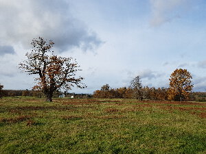
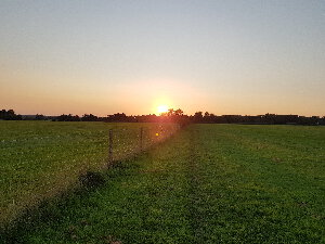
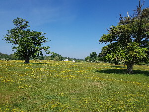
A peaceful walk through wide open spaces with views of hills & countryside.
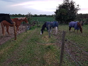
| Distance Duration | 8.5km (5.3 miles) 1.9 hours | Highlights | Crowsley Park Dunsden Green Loddon Brewery Highlands Park |
Henley to Dunsden Green via Sonning
Stunning views of Sonning, the Marina & Reading before descending towards Sonning and the Thames Path towards Henley.
| Distance Duration | 13km (8.1 miles) 2.9 hours | Highlights | Dunsden Green Loddon Brewery Reading View Shiplake Flowing Spring Pub Sonning |
Henley to Dunsden Green via Shiplake
| Distance Duration | 10.8km (6.7 miles) 2.4 hours | Highlights | Binfield Heath Church Dunsden Green Loddon Brewery Shiplake Shiplake Row |
Henley to Maidenhead via Hurley & BCA
| Distance Duration | 17km (10.6 miles) 3.8 hours | Highlights | BCA - Berkshire College of Agriculture Culham Chapel Deer Park Hurley Bottom Hurley Village A404 Footbridge Maidenhead (Station) Maidenhead Thicket |
Henley to Reading via Dunsden Green & Caversham
The shortest route between Henley and Reading, approximately 3km (2 miles) shorter than routes involving the Thames Path.
| Distance Duration | 13.5km (8.4 miles) 3.0 hours | Highlights | Caversham Park Dunsden Green Emmer Green Highlands Park Christchurch Meadows Reading (Station) |
Henley to Reading via Dunsden Green & Sonning
| Distance Duration | 16.5km (10.3 miles) 3.7 hours | Highlights | Crowsley Park Dunsden Green Reading View Highlands Park King's Meadow Reading (Station) Thames Valley Park Flowing Spring Pub Sonning Sonning Lock |
Henley to Wargrave via Remenham Hill
| Distance Duration | 9km (5.6 miles) 2.0 hours | Highlights | The Little Angel Remenham Hill Hennerton Golf Club Town Centre St Mary's Church Wargrave Station |
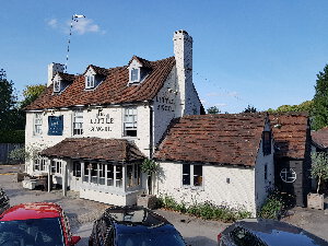
Henley to Twyford via Remenham Hill & Wargrave
| Distance Duration | 11.5km (7.1 miles) 2.5 hours | Highlights | The Little Angel Remenham Hill Hennerton Golf Club Town Centre St Mary's Church Sheeplands Farm Town Centre |
Henley to Wargrave via Aston & Culham Court
Approximately 2 miles longer than more direct routes in order to walk through the beautiful Culham Court Deer Park, past the Culham Court Chapel and through Crazies Hill where The Horns pub awaits after 9km. NOTE: After about 5.5km, the trail meets the A4130 opposite Culham Lane. Walkers my wish to cross the road at this point where traffic is much slower and walk straight down Culham Lane, picking up the footpath after 600m. Following the footpath East down the A4130 will mean crossing at a point where cars are much faster.
| Distance Duration | 12.5km (7.8 miles) 2.8 hours | Highlights | Culham Chapel Deer Park Cockpole Green Crazies Hill The Horns Pub Town Centre St Mary's Church Wargrave Station |
Henley to Goring via Highmoor, Stoke Row & Checkendon (Scenic Route)
Perhaps not the shortest route between Henley and Goring but certainly the most interesting with many unique sights along the way.This route takes you through the beautiful villages of Stoke Row, home of Maharajah's Well, and Checkendon, home of the famous Nuba Survival scuplture. There are several quality pubs along the way including the Rising Sun at Highmoor, the Cherry Tree in Stoke Row and the Highwayman Inn in Checkendon so you will never be far from refreshments on this all-day adventure.
| Distance Duration | 24km (14.9 miles) 5.3 hours | Highlights | Nettlebed Estate Nettlebed Estate Statue Checkendon Highwayman Inn Nuba Survival Sculpture Sculpture Garden Hartslock Nature Reserve Rising Sun Cherry Tree Maharajah's Well St. John the Evangelist Church Village Store |
Henley to Goring via Sonning Common
This relatively direct route between Henley and Goring is one of the most wooded routes in our database which provides plenty of shelter from the sun on hotter days.
| Distance Duration | 19km (11.8 miles) 4.2 hours | Highlights | Highwayman Inn Goring Pack and Prime Lane Rotherfield Greys Rotherfield Peppard Spring Wood College Wood |
Henley to Pangbourne via Crowsley & Kidmore End
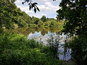
This route to Pangbourne takes you out of Henley, into the beautiful Crowsley Park and past Crowsley Park House into the village of Crowsley. From there the route passes the Bird in Hand pub, then crosses Millenium Field and on to Kidmore End. The route then travels through woodlands and across the Hardwick Estate before descending into Whitchurch-on-Thames and over the bridge into Pangbourne.
| Distance Duration | 18km (11.2 miles) 4.0 hours | Highlights | Hardwick Estate Crowsley Park Kidmore End Bird in Hand Melancholy Hill Whitchurch-on-Thames |
Henley to Pangbourne via Sonning Common & Whitchurch Hill
We head out of Henley walking the full length of the historic Pack and Prime Lane then head towards Rotherfield Peppard then on to Sonning Common.On leaving Sonning Common the route takes several twists & turns through multiple copses and woodlands before dropping into the village of Whitchurch Hill.From there the route follows the footpath straight down the hill into Whitchurch on Thames then crosses the bridge into Pangbourne.
| Distance Duration | 18.5km (11.5 miles) 4.1 hours | Highlights | Highwayman Inn Pack and Prime Lane Rotherfield Peppard Spring Wood College Wood Whitchurch Hill Whitchurch-on-Thames |
Henley to Marlow via Remenham and Hurley
The shortest, gentlist and most attractive route from Henley to Marlow. Primarily following the Thames Path from Remenham, the route crosses the river at Hurley Lock and Temple Lock before heading straight into Marlow through Higginson Park.
| Distance Duration | 12.5km (7.8 miles) 2.8 hours | Highlights | Flower Pot Bisham Hurley Lock Hurley Riverside Park Marlow Culham Chapel Deer Park Temple |
Henley to Pangbourne via Mapledurham
| Distance Duration | 20km (12.4 miles) 4.4 hours | Highlights | Crowsley Park Mapledurham Pangbourne Whitchurch-on-Thames |
Henley to Wallingford via Greys Green and Nuffield
| Distance Duration | 20km (12.4 miles) 4.4 hours | Highlights | Happy Valley Nuffield Ridgeway Greys Green Pindars Wood Wallingford |
Henley to Reading via Crowsley and Caversham
Probably the shortest, almost entirely, off-road route between Henley and Reading taking walkers out of Henley via Highlands Park, over Crowsley Park, then through Crowsley into Caversham and down into Reading via Balmore Park which provides walkers with an excellent view of Reading Town Centre from a distance.
| Distance Duration | 13.4km (8.3 miles) 3.0 hours | Highlights | Balmore Park Crowsley Park Highlands Park Christchurch Meadows Reading (Station) |
Henley to Reading via Shiplake and Sonning Thames Path
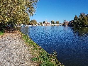
This is a very pleasant and simple route into Reading following the River Thames to Shiplake, Sonning and Thames Valley Park before heading inland along Kennetside and following the River Kennet all the way into Reading, ending at the Oracle Shopping Centre.
| Distance Duration | 15km (9.3 miles) 3.3 hours | Highlights | Marsh Lock Marsh Meadows Mill Meadows Oracle (Riverside) River Kennet (Kennetside) Thames Valley Park Shiplake Sonning Sonning Lock |
Henley to High Wycombe via Hambleden, Frieth & Wycombe Air Park
| Distance Duration | 21km (13 miles) 4.6 hours | Highlights | Frieth Hambleden High Wycombe Tom Burt's Hill Wycombe Air Park (Booker) |
Henley to High Wycombe via Skirmett, Fingest, Cadmore, Piddington & West Wycombe
| Distance Duration | 22.5km (14 miles) 5.0 hours | Highlights | Cadmore End Fingest Dashwood Roadhouse Skirmett West Wycombe |
Henley to High Wycombe via Hambleden, Frieth & Lane End
| Distance Duration | 20km (12.4 miles) 4.4 hours | Highlights | Frieth Hambleden Stag & Huntsman High Wycombe Sands Bank Nature Reserve Lane End |
Henley to Marlow via Hambleden & Bovingdon Green
| Distance Duration | 13km (8.1 miles) 2.9 hours | Highlights | Royal Oak Pub Hambleden Stag & Huntsman Marlow |